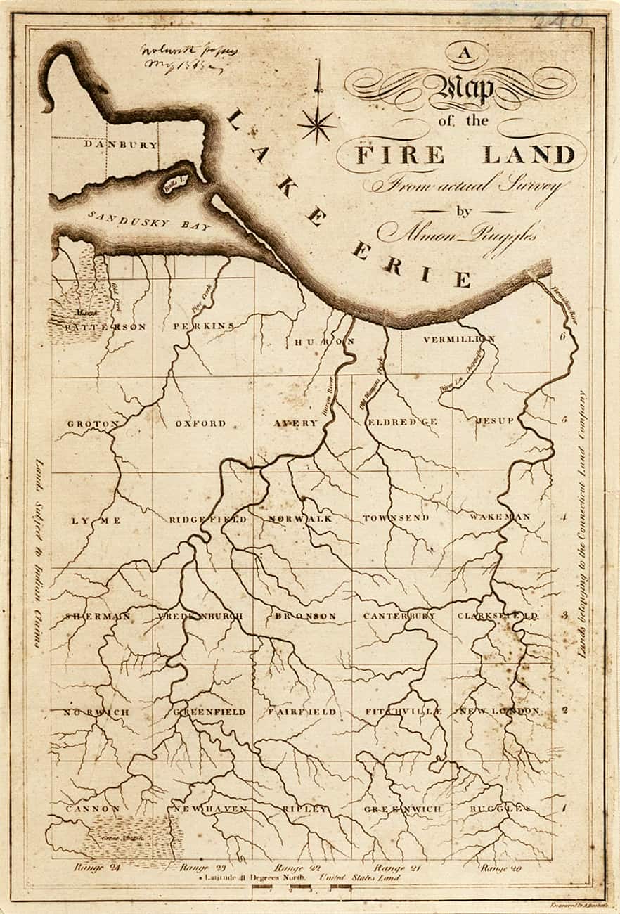
“Resolved by this Assembly, that there be and there hereby is released & Quit Claimed to the Sufferers hereafter named or their legal Representatives where they are Dead, and to their Heirs and Assigns forever,
Five Hundred Thousand Acres of the Lands belonging to this State lying West of the State of Pensulvania and bounding Northerly on the Shore of Lake Erie, beginning at the West Line of said Lands and extending Eastward to a Line running Northerly & Southerly paralel to the East Line of said Tract of Land belonging to this State and extending the width of said Lands and Easterly so far as to make said Quantity of Five Hundred Thousand Acres of Land
exclusive of any Lands within said Bounds if any be which may have been heretofore Granted to be divided to and among the said Sufferers, and their Legal Representatives, where they are Dead in proportion to the several Sums Annexed to their Names as follows in the annexed List.”
From the Connecticut General Assembly records, May 1792
A Map of the Fireland From actual Survey | 1808 | Almon Ruggles, Surveyor | Engraved by Amos Doolittle